Home
Solutions

Pricing

License imagery and map data in your area of interest. Annual subscription plans with pricing based on the area's road network length.

Package Selection

If your shooting is under 1000km, you can contact us to get a free trial.

Get Hosting(Optional)

1000km corresponds to approximately 200,000 pictures. This price is based on five meters distance calculation.

Choose your private Imagery hosting

Use the Mapilio platform for imagery that’s not shared with the public. Monthly plans based on the number of images hosted (automatically extracted data needs to be licensed separately).

Package Price


1,000 km road coverage

$

Frequently Asked Questions

We provide on-demand street-level data through personalized orders, with prices determined by the product type and geographic region, starting at $500 USD. Additionally, pre-captured data is available for purchase at discounted rates. The cost varies based on location, product type, and the size of the area covered.
It depends on a few factors, such as local operator or community member availability, the size of the area requested, the kind of camera data requested, and varying data uploading times depending on where the data is uploaded. When you order imagery data, we will send you a time estimation as part of your quote.
Object detections refer to specific items identified within street-level images, created using advanced semantic segmentation models. When you license object detections, you receive a dataset with the locations of images containing these detections.

In contrast, map features are created by triangulating multiple detections of the same object into points or lines on a map. This process is based on 3D reconstruction of the location from the imagery, utilizing the Structure from Motion technique. Licensing map features provides you with a dataset including the estimated positions of the actual objects.
Mapilio’s algorithms are capable of detecting an extensive range of objects typically found in street scenes, including a detailed classification of hundreds of different traffic signs. There are 65 types of objects that you can license as object detections, which include the positions of the images where these objects were detected.

Furthermore, for triangulated map features, which show the positions of objects on the map, there are more than 500 classes of traffic signs and 32 types of other objects available for licensing.

If you require the detection of a traffic sign or object that is not currently listed in our catalog, you can reach out to sales team at [email protected] for assistance.
Detection capabilities: The traffic sign detection technology by Mapilio has demonstrated a remarkable success rate, exceeding 90% in both precision and recall metrics. Our semantic segmentation systems are recognized as some of the top performers globally for interpreting road environments. For detailed insights on object type-specific accuracy, we encourage consulting our scholarly publications.

Positional accuracy: The precision in mapping feature locations is contingent on the 3D reconstruction quality of the specific site. This is significantly influenced by the GPS precision of the capturing device and the concentration of photographic data in that vicinity. Given that Mapilio’s database comprises images from a wide range of sources and devices, there is a natural variation in the positional accuracy of mapping features across different areas.

For those capturing their own images: It's advisable to employ high-resolution cameras paired with the most accurate GPS receivers that fit your budget. Close-range image capturing is recommended to enhance overall accuracy.
Data obtained from Mapilio is available in either GeoJSON or shapefile formats. This data can be accessed directly through your organization's dashboard on the Mapilio web application, or it can be retrieved via the Mapilio API.
You have the option to download thumbnail versions of Mapilio’s public images, with a maximum width of 2048 pixels. Additionally, you can download original versions of the images you have personally contributed. If you subscribe to Mapilio’s public imagery service, you are permitted to use and access these images for commercial purposes via the Mapilio platform, its integrations, and APIs. However, downloading the original image files is not possible.
Our global network of contributors is dedicated to capturing images worldwide, and we offer a marketplace where you can publish mapping requests to acquire coverage in your desired location. For more information and to discuss your specific needs, please reach out to us at [email protected]
We provide our data on a subscription basis to accommodate the continuous expansion and updating of imagery and data for each specific area of interest. Subscription pricing covers the ongoing updates in imagery and data throughout the duration of your subscription, accounting for the addition of new images, extraction of more data, and enhancements in Mapilio’s computer vision algorithms. However, if you're only interested in a one-time data pull and do not require subsequent updates, you can choose to extract the data just once within the subscription period.
Our platform is free for anyone to use, and all its public imagery is accessible as open data under the CC BY-SA license. This means that any work derived from this imagery, like maps or geospatial datasets, must also be shared and attributed under the same license if they use Mapilio imagery as a reference.

However, if the CC BY-SA license does not fit your requirements, you'll need a subscription to obtain a commercial license for the imagery and the associated metadata. This also applies to accessing the automatically extracted data, such as object detections and map features, under a commercial license.

For imagery that you have personally contributed, there's no charge. You (or your organization) retain ownership of this imagery and have the freedom to use it as desired, including on the Mapilio platform.
In case the image coverage in your desired area is lacking, you have the option to boost it yourself by capturing and uploading images. Additionally, Mapilio collaborates with various partners specialized in image capturing, and we maintain a marketplace that facilitates the connection between those requiring image capturing services and providers. If you're considering delegating the image capturing task, please inform us of your interest in exploring external capture solutions.
Mapilio gathers imagery through its community network and collaborates with regional professional service providers, entrepreneurs, and organizations. We contribute to local communities by creating job opportunities. Employing local operators ensures they are fluent in the local language, familiar with the culture and environment, and possess the necessary documentation and licenses for data collection. This approach is more sustainable, as it eliminates the need to transport personnel and equipment globally for data collection, and it supports the empowerment of local communities.

Mapilio aims to make the world accessible to everyone by creating better maps from images.

GDPR Compliant

Your data is safe with us

OpenStreetMap

About

About Mapilio
Blog
Forum
Contact

Privacy Policy|Cookie Policy|Terms & Conditions-Licenses|Data Processing

© Mapilio. 2025. All rights reserved

Join the challenge

gift popupContribute

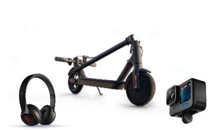
Earn gifts from Footage you capture at street level!