Make smart maps
Mapilio's platform creates smart map data using street-level images.
Join over 5000 subscribers for our newsletter
Supports industry leading companies


Mapilio's Global Spread
Mapilio processes thousands of kilometers of data captured every day around the world, analyzes objects and creates meaningful map data
8.352.331KM
83+Countries
591+Classes
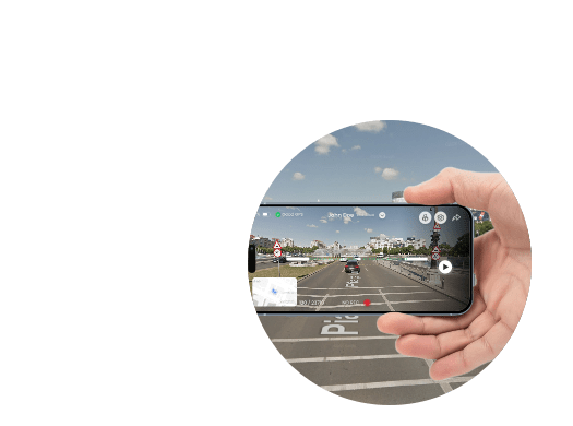
Capture, upload, and use Street-level imagery and data
Contribute with your captures, manage map data, and bring it all to your mapping and GIS workflows with our apps and tools.
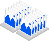
- Manage images under your control
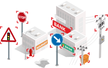
Let AI speed things up.
Speed and scale up mapping
Cut down on human-workload and keep up with change by using machine ‑ extracted map features.
- Process data fast with artificial intelligence
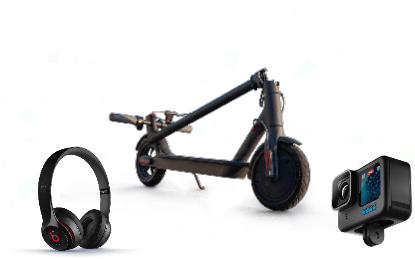
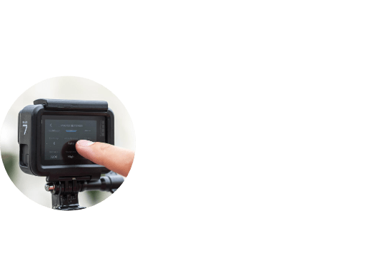
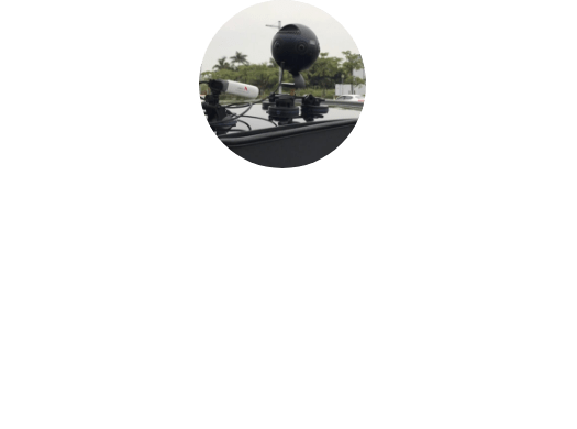
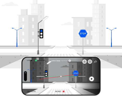
Capture your own street-level imagery
Capture imagery with any kind of camera to put places on the map through a collaborative street-level view of the world.
- Start capturing now
Data for the whole world
Checkout best street-level imagery on popular destinations.
Open map data
Open data with Mapilio
Contribute and make publicly available your street-level image and map data on the Mapilio platform. Data available on the map platform OpenstreetMap
Capture and upload
Mapilio is a platform consisting of images made by individuals. Contribute to the strengthening of our community and the improvement of the quality of our maps. Both individuals and organizations can benefit from these inputs.

Take advantage of others' contributions
Benefit from the platform's overall database, which gets richer as each member contributes. Like a sports team, every individual's performance makes your life easier.

Make a global impact
Let the database of members' images contribute to common mapping applications used around the world, like OpenStreetMap let's make sure everyone has access to better maps.
Frequently Asked Questions
Which cameras can I use for shooting ?
If I took only one photo, can I upload it ?
How long does it take till my photos are uploaded to the map ?
Which actions do you take to protect privacy ?
How can I earn from this platform ?
1) #CompleteMap Challenge
- The easiest way to win at Mapilio is to participate in competitions. By uploading photos to our system, you can gain coupons or money. Main aim of these competitions is encouraging people to contribute in their area and is called #CompleteMap challenge.
- All you have to do is capturing images in the challenge area, with the aim to cover all unmapped roads and paths with some additional characteristics.
- A global leaderboard will allow you to compare your local contributions with other participants. The leaderboard will have a scoring system that will take into account multiple elements of contribution. Here are the variables that make up the score:
- Unique kilometres (UKM): this is the total distance of sequences contributed in areas with no previous coverage. For example, if you drove for 10 km and 7 km of it did not have existing imagery, your UKM for that drive would be 7 km.
- Images: the total number of images the contributor has uploaded during the challenge.
- Participants: this is the number of people participating in your local challenge. The idea is to encourage and reward collaboration.
Score = (total UKM contributed + (images/1000)) * (1 + (count of participants/10)) - How you can participate
- 1 . Ask us to set up a challenge for you by submitting a request with your desired location here.
- 2 . Tell others about the challenge and invite them to contribute in your area.
- 3 . Begin capturing imagery within your chosen area from December 11th onwards.
- 4 . Maximise the number of unique kilometres, images, and participants to increase your score.
- 5 . Check the Global #CompletetheMap leaderboard to see what other localities globally are up to and how you compare.
How many kilometers of roads can I shoot ?
When i upload a photo, does it belong to you now ?
Fast and accurate data
Imagery and Map data
Access street-level imagery and map data from all over the world. Fill in the gaps by capturing coverage yourself

Start sharing images and accessing map data now.
Mapilio is an independent provider of street-level imagery and map data, not affiliated with OpenStreetMap or any specific map platform.
This website uses cookies to improve user experience. By using our website, you consent to all cookies in accordance with our Cookie Policy.